Walkabout Colt
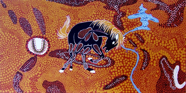
Inspired by the Australian Aboriginal tradition of topographical land dot map paintings, this painting represents a topo map of the Rawlins Wyoming region. It spans approx. 100 x 60 miles, west from Red Desert and the Rawlins uplift to the Medicine Bow Range in the east, south to Saratoga, and following north along the North Platte River to the Seminoe Reservoir and the Ferris Mountains.
The dots represent drops of water, the rain fills our rivers. The dots also represent all the plants, birds, animals, insects and people that drink and are made from this water, our lifeblood. The higher ground is represented by the black dotted areas with a sprinkling of snow.
The Colt is the mascot for the Rawlins Middle School. Rawlins township is represented the large white circle with the Middle School Colt's horseshoe symbol. Our painting was designed and painted in 2012 by the 7th grade art class with art teacher Marj McCrae, in collabortion with artist in residence Paul Taylor. Special thanks to Kathy Neuman and the Boys & Girls Club who sponsored this residency.
This painting teaches us to care for our land and water.


